Snowdonia &
Eryri Day Walks.
Cwm Idwal in 35 minutes. Aber Falls in 25. Yr Wyddfa in under an hour.
A genuinely civilised base
for serious mountain walking.
Since November 2022, Snowdonia has been officially Eryri National Park — and Snowdon is Yr Wyddfa. Both names deserve to be used. The Park’s own website is eryri.gov.wales, the definitive source for routes, conditions and parking.
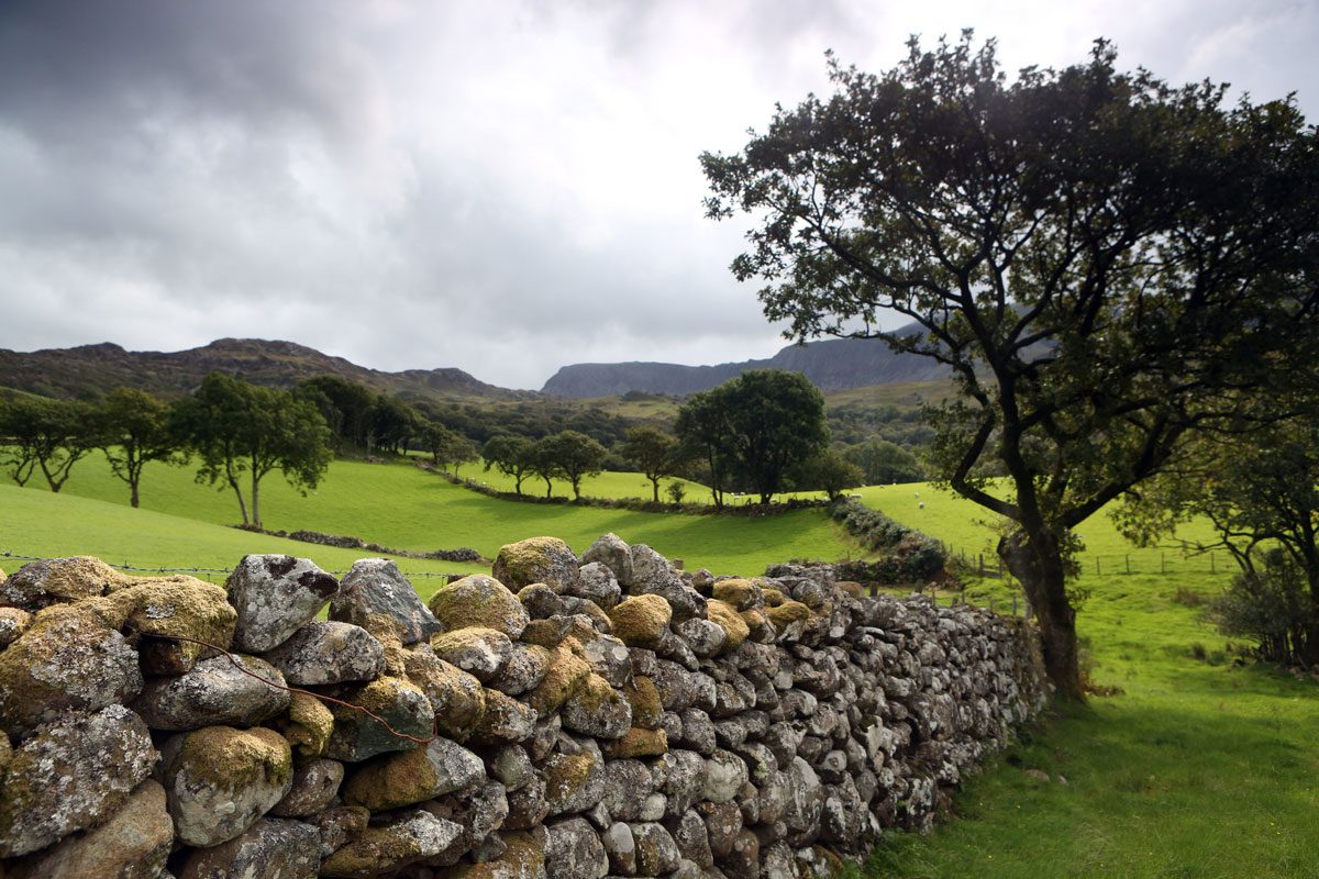
Llandudno is not the obvious choice for a Snowdonia walking base — but it should be. The drive times are shorter than most people expect, the town offers a genuinely good range of restaurants and accommodation, and after a long day on the mountain there is something restorative about returning to a quiet street by the sea rather than a car park in a mountain village.
Drive Times to Key Trailheads
| Destination | Drive | Best for |
|---|---|---|
| Conwy Mountain | 5–10 min | Half-day hillfort walk, wild ponies |
| Bodnant Garden (NT) | 15 min | Garden walks, Laburnum Arch (May/June) |
| Aber Falls (Abergwyngregyn) | 25 min | Easy waterfall walk, family-friendly |
| Ogwen / Cwm Idwal | 30–35 min | Glacial cwm, Glyderau, Tryfan scramble |
| Betws-y-Coed | 30 min | Gwydir Forest, Fairy Glen, Conwy Falls |
| Capel Curig / Moel Siabod | 40 min | Mid-grade mountain, 13-peak view |
| Llanberis | 45–50 min | Snowdon Mountain Railway, Llanberis Path |
| Pen-y-Pass | 55–60 min | Pyg Track & Miners' Track (pre-book parking) |
| Rhyd Ddu / Beddgelert | 60–65 min | Quietest Snowdon paths, Glaslyn valley |
The Walks We Recommend
Cwm Idwal
Wales’ first National Nature Reserve (designated 1954), Cwm Idwal is a glacially carved cwm of extraordinary drama — a hanging valley of rock, lake and arctic-alpine flowers beneath the towering cliff face of Idwal Slabs. Charles Darwin studied the geology here; the Snowdon Lily (Lloydia serotina) grows on the cliffs.
The circular walk around Llyn Idwal takes around 90 minutes at a comfortable pace and reaches the foot of the famous Devil’s Kitchen (Twll Du) ravine.
Aber Falls
Rhaeadr Fawr — Aber Falls — is the closest genuinely spectacular waterfall to Llandudno. At 37 metres high, it is a proper cataract, and the approach on a wide, mostly gravel path through ancient oak woodland is a delight in itself.
The path from Bont Newydd car park is suitable for pushchairs and wheelchairs for much of its length, making this a genuinely family-friendly option that doesn’t feel like a compromise. In wet weather, the falls are particularly dramatic.
Yr Wyddfa (Snowdon)
At 1,085 metres, Yr Wyddfa is the highest peak in Wales and England — and one of the most walked mountains in the world. Eryri National Park grades all six paths as Hard / Strenuous. None should be underestimated; check the Mountain Weather Information Service before setting out.
The Snowdon Mountain Railway — Britain’s only public rack-and-pinion railway — offers a non-walking alternative from Llanberis, running daily April to October.
Pen-y-Pass parking (2026): Pre-booking required 28 March–1 November via JustPark. Costs from £25 for up to 8 hours. Capacity just 68 cars and the A4086 is a clearway — use the Nant Peris Park & Ride (£5/day) with Sherpa bus S1/S2 instead. Book at eryri.gov.wales.
| Path | Distance | Ascent | Time | Character |
|---|---|---|---|---|
| Llanberis | 9 mi / 14.5 km | 975 m | 6–7 hrs | Longest, gentlest gradient. Follows railway line. Most popular. |
| Pyg Track | 7 mi / 11 km | 723 m | ~6 hrs | Steep, rocky and dramatic from Pen-y-Pass. Magnificent views. |
| Miners' Track | 8 mi / 13 km | 723 m | ~6 hrs | Gentle start past Glaslyn lakes. Steep, loose finish. |
| Rhyd Ddu | 8.5 mi / 13 km | 895 m | ~6 hrs | Quietest path. Exposed ridge section on Bwlch Main. |
| Snowdon Ranger | 8 mi / 13 km | 935 m | 5.5–7 hrs | Oldest path. Gradual and scenic. |
| Watkin | 8 mi / 13 km | 1,015 m | 6–7 hrs | Greatest ascent. Beautiful woodland start. Loose scree finish. |
⚠ Crib Goch is not a walking route — it is a Grade 1 knife-edge scramble requiring hands throughout and carrying significant mountain rescue risk. Similarly, Tryfan’s North Ridge is a sustained scramble. Both are outstanding for those with the right skills, but not routes for inexperienced walkers.
The Sherpa Bus.
Snowdonia without a car.
Take the Conwy Valley Railway from Llandudno to Betws-y-Coed (~47 min, 4–5 trains a day), then connect to the Sherpa’r Wyddfa bus for Capel Curig, Pen-y-Pass and Llanberis.
Sherpa runs 28 March to 1 November 2026. A day ticket is around £7 adult, unlimited Sherpa travel. This is the recommended approach for Pen-y-Pass, where car parking is severely limited.
- Check the weather mwis.org.uk — Snowdonia forecast updated twice daily.
- Tell someone Leave your route and expected return with us before you head out.
- Proper footwear Waterproof walking boots are essential, not trainers.
- Navigation OS Explorer OL17 plus compass. Phone signal unreliable.
- Emergency 999, ask for Police, then Mountain Rescue.